Waypoints
Waypoints are points along a route, also known as markers or turnpoints.
Waypoints or XCNav?
The Waypoints module allows for managing lists of waypoints/turnpoints with no connections between them. The distance between each point is not important. They are intended to be used in GPS: while flying, perform a goto to a point, define a route by selecting them successively (e.g., a competition task).
In the XCNav module, you enter points that will be milestones along the way. The distance between each point is essential.
The XCNav module allows for drawing an itinerary consisting of a series of connected waypoints. Each waypoint is linked to the next one.
Formats
Logfly can read the following formats:
- OziExplorer: extension wpt. A very widely used format. For each competition, the FFVL places a free downloadable wpt file on its corresponding page.
- GPX: extension GPX. Probably the most widely used format in GPS devices.
- CompeGPS: extension WPT. A proprietary format of the CompeGPS software, widely used in free flight.
- Kml: extension KML. A format used by the Google Earth software, widely distributed.
- Cup: extension cup. A format used by the See You software from Naviter.
Choose a file
An option to open a waypoints file. The format is automatically detected among those listed above.
All waypoints are displayed on the map.
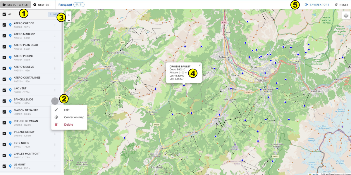
- List of waypoints with display on the map managed by a checkbox
- Clicking on the icon displays an editing window: Edit, center on the map, delete
- Button New: creation of a new waypoint
- Clicking on the point displays its characteristics
- Save / Export in one of the formats listed above
New set
Define a new set of waypoints that will be saved in the formats listed above.
The creation window is immediately displayed
Creation/Modification
The creation or modification of a waypoint is managed by a lateral window
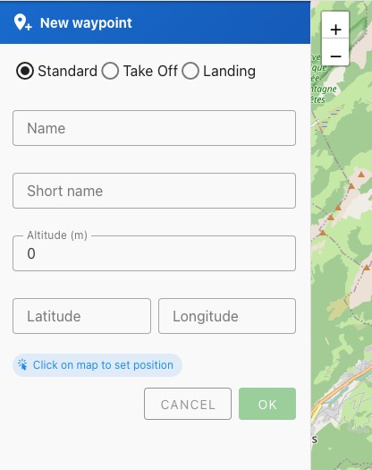
- Choose the type of waypoint : standard, take-off or landing
- Enter the name
- Enter the short name (Cf Naming)
- Enter the altitude
- Coordinates: enter by clicking on the map. If needed, move the orange circle while holding down the left mouse button