How it works
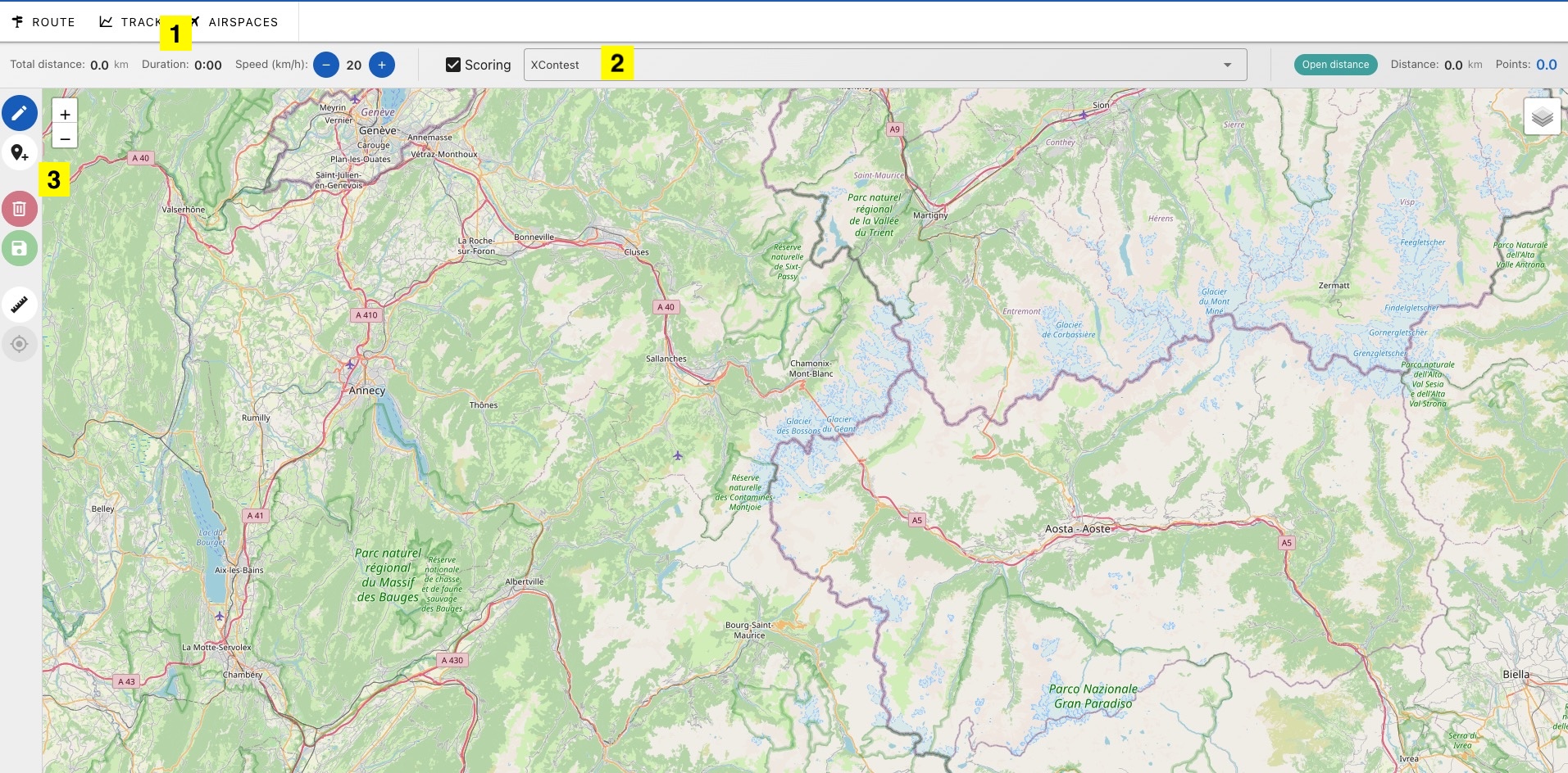
1. File Menu
- Route : display/modify a saved route with Logfly or another application like FlyXC
- Trace : display a track that can be used as the basis for a route
- Airspaces : download airspaces
2. Information
- Total Distance : total distance of all segments
- Duration : estimated time with the selected average speed
- Speed : average speed envisaged on the course. Modifiable by + and - keys
- Score : display/hide the route score
- Scoring Rule Selection
- Score : scoring of the displayed route: type of track value, scored distance and number of points
See below for the section Distance and Scoring
3. Actions
 draw the route. See the page Drawing
 add markers. See the page Markers
 completely erase the displayed drawing (route + possible markers)
 save the displayed drawing. See the page Saving
 measure between different points on the map without interfering with the drawing
 recenter the map to the entire route
Display a Route
A saved route can be searched and displayed with the Route button. The route may come from another application.
Logfly displays the following formats: GPX, SeeYou (cup), Google Earth (kml), XCtrack, GPSDump (wpt)
Display a Track
A track or tracks recorded in IGC or GPX format can be displayed on the map. Important thermal points will be drawn in yellow.
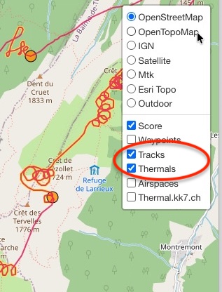
You can activate/deactivate display of the trace and thermal points using the layer selector at top right
Airspaces
The filtering window allows you to choose which airspaces to display. The default values are the most common and used ones.
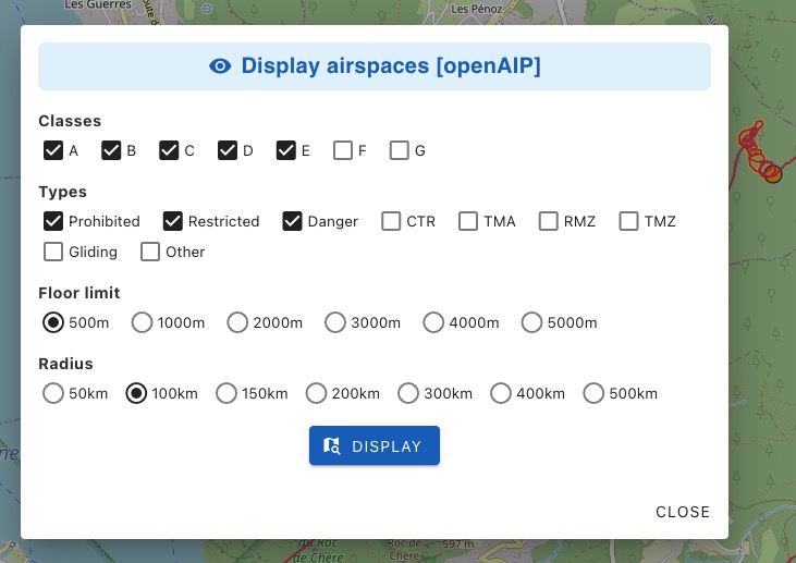
The most important parameter is the radius of airspace search. The reference point for this radius is the center of the map. If your route project is large enough, don't forget to use the button which re-centers the map around the route project.
Distance and Scoring
The information bar displays the total distance of all segments and the estimated time for a selected average speed. The default average speed is 20 km/h, but this can be modified using the - and + buttons. The update is immediate.
By default, route scoring is enabled. It can be disabled by clicking on the checkbox next to the word scoring. Scoring is calculated according to the selected rule: FFVL, XContest, FAI, and XCLeague. For more details on scoring rules, see the page Scoring.
The score is updated immediately. By clicking on the last point and moving it towards the yellow circle, the score will change. You will switch from a free distance to a triangle. The colored sectors that appear display the possible FAI triangles. Move the triangle points to these sectors to update the score.
Layer Control
With the layer control located at top right of the screen, you can change the type of map displayed (OpenStreetMap, IGN, etc..). You can add layers in overlay mode. You can display all thermals in the sector. This is possible thanks to the site's authorisation from thermal.kk7.