How it works
The Airspaces module allows you to display and manage airspace files in OpenAir format. These files are simple text files with a format described on the Winpilot website.
For France and parts of Europe, the best source is Pascal Bazile's site, which performs extensive work in sorting and organizing data related to our activity. The @Bazile link allows you to directly download the latest version for France from Pascal Bazile's site.
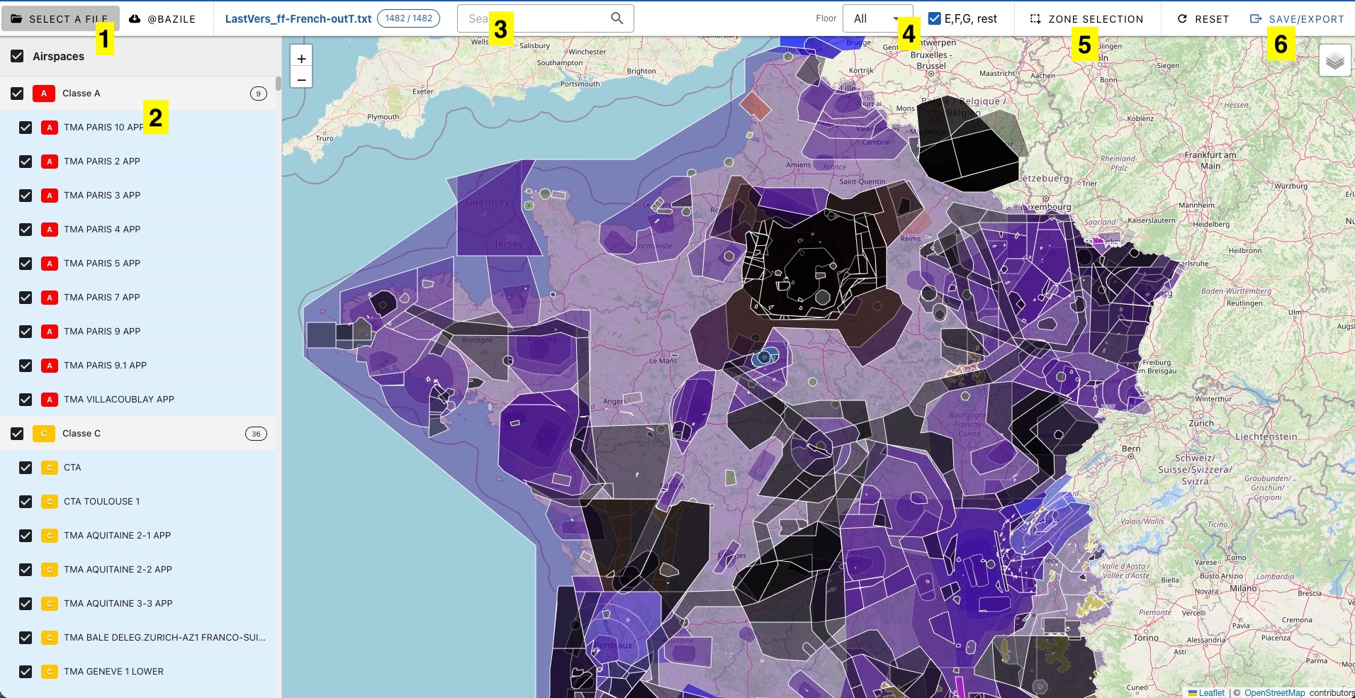
1. Choose a file
- Select a local file using the file selector
- Download the latest version for France from Pascal Bazile's site
2. Display
Airspaces are grouped in a tree-like structure, organized by class. Unchecking a class unchecks all spaces belonging to that class.
By default, all spaces from a file will be displayed. However, you will have the option to filter them. See the paragraph below for more information on filtering.
A click on an item in the center list will center the map on the selected space.
3. Search
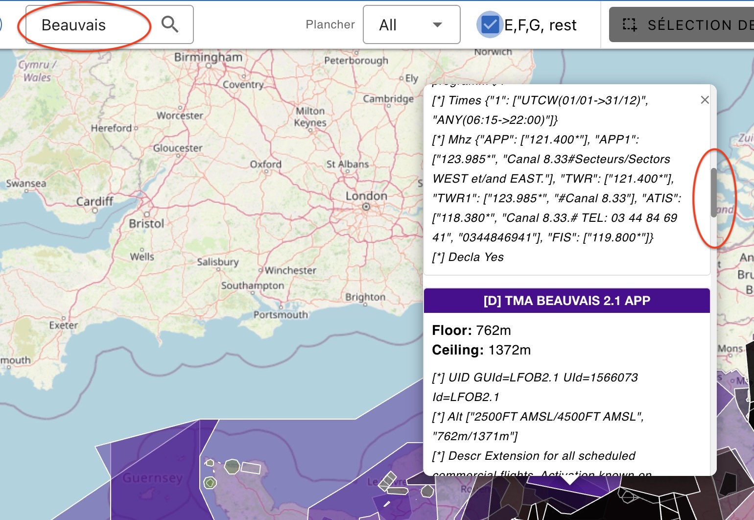
You have a search box to find airspaces by name. For example, searching for Beauvais will display all spaces containing that name. If multiple spaces contain the searched name, there will be a vertical scroll bar on the popup information window.
4. Filter
You can filter the display by level of floor in the dropdown menu:
- The "All" option means displaying all spaces present in the file as is
- The "1000 m" option indicates that all airspaces with a floor below or equal to 1000 m will be displayed
- The "2000 m" option means that all airspaces with a floor below or equal to 2000m will be displayed
The checkbox E,F,G res allows you to display or hide classes E, F, G, and restricted.
5. Zone selection
Allows you to select a rectangular area where only spaces within this frame will be displayed.
It is possible to cancel the selection.
6. Export
After filtering, selecting, and unchecking, you can export the displayed result. Logfly will save only the checked zones from the tree-like structure being displayed. This export is done in Open Air or GPX format.
The GPX format allows sending airspace areas as paths to Garmin GPS devices using GPSDump.