XCNav
The XCNav module allows you to draw a route consisting of a series of waypoints to be linked together. Each point is connected to the next.
XCNav or Waypoints ?
This module is intended for preparing XC routes and is not very different from existing applications like FlyXC.
In XCNav, you enter points that will be the milestones of a route. The distance between each point is an essential criterion.
The Waypoints module allows managing lists of waypoints/markers with no links between them. The distance between each point has no importance. They are intended to be used in GPS: during flight, go to a point, define a route by selecting them successively (competition task, for example).
Usage
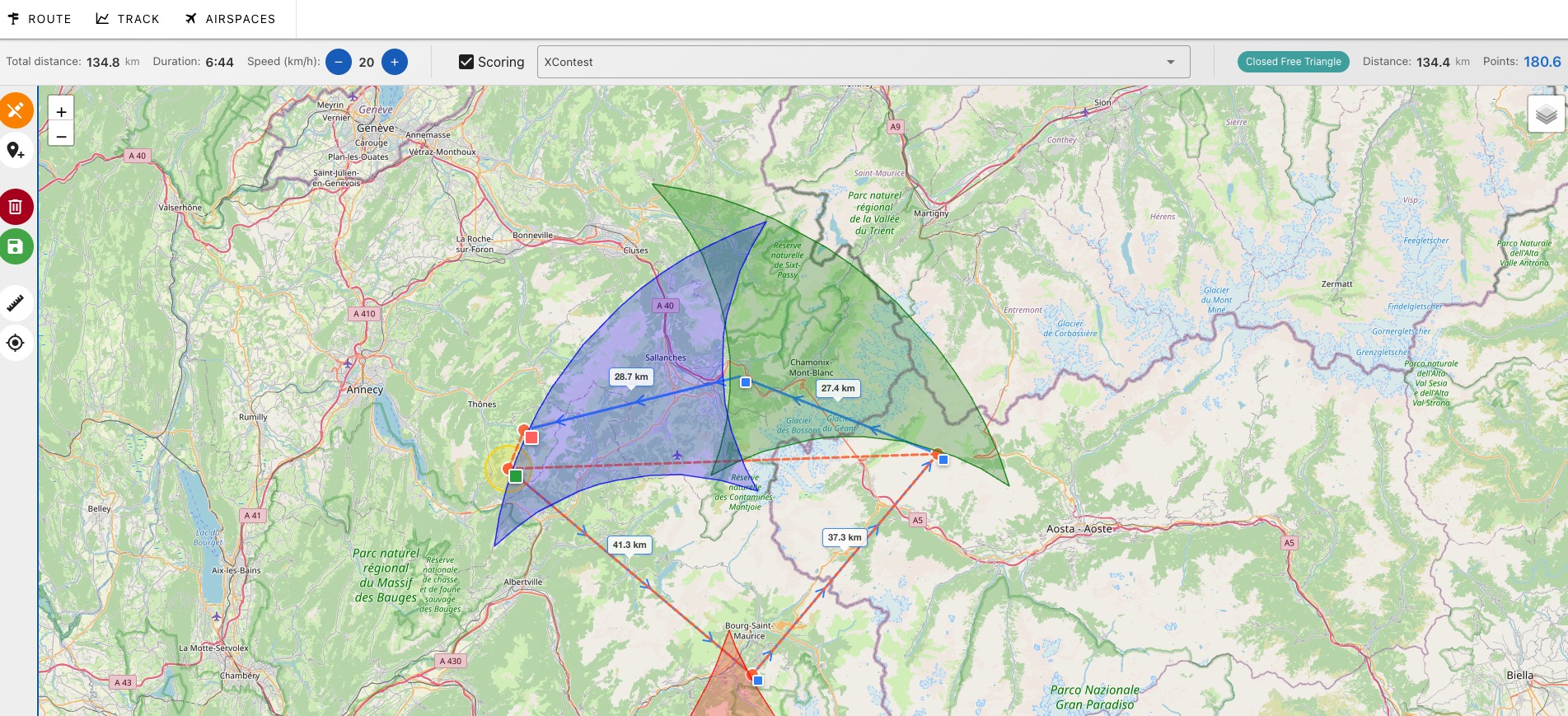
Once the route is defined, XCNvav allows recording points defined in several formats and for two different uses:
Software like XCTrack, XCSoar
For applications like XCTrack or XCSoar, a route is a simple list of waypoints, which will be interpreted as a competition task. This implies passing through all turnpoints. If you decide not to pass through a turnpoint for any reason, you must manually intervene on the GPS to go to the next turnpoint. This is not necessarily easy in XC flying where the goal is to adapt to the conditions of the day.
Map software like OruxMaps, Mapy.cz
This module allows generating a route and markers that can be used by simple smartphone cartographic applications such as OruxMaps, Mapy.cz or Bergfex. In flight, the current track is displayed next to the 'drawing' of the route and allows you to check where you are. You can prepare several routes in the same area and display them all together.
You can insert route points like a known thermal without being forced to pass through it. If conditions for the day are great, you'll go directly to the next point. You may add markers to signal points of interest outside the planned course: for example, landings or known thermals. This allows you to have some information in case of changes to your plans.
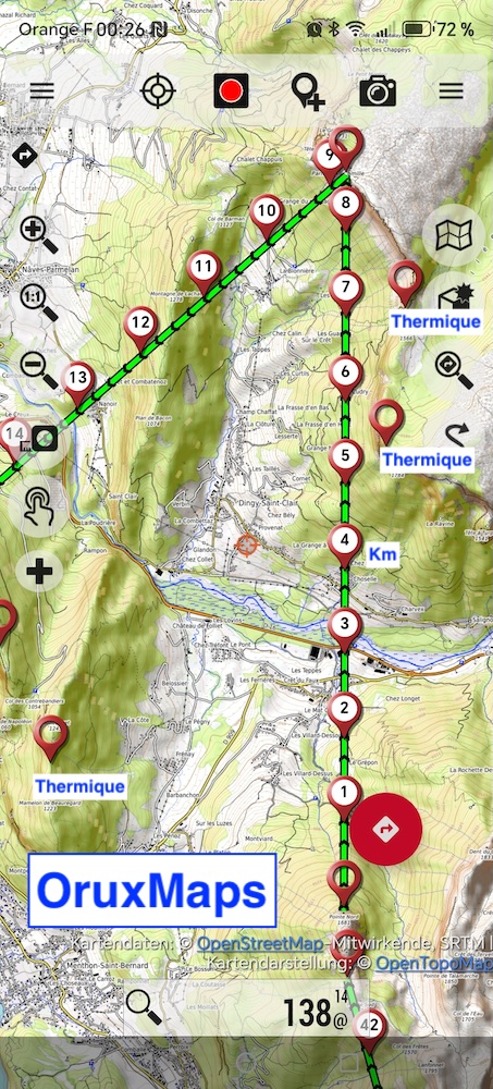
This module also allows easily recording projects on the computer, reading them, improving them, sharing them, etc...
Route scoring is optional. This can allow developing route projects for pedestrian hiking without displaying storage sectors on the map.
Note: The text has been translated from French to English while preserving the original Markdown structure and code blocks.